A service for measuring horizontal surface displacements from time-series of optical satellite images is currently being integrated by EOST (Ecole et Observatoire des Sciences de la Terre / Joint Research Unit of CNRS and University of Strasbourg) into the GEP. The service uses an image correlation technique for detecting and quantifying displacement at sub-pixel precision. MPIC (Mulitple-Pairwise Image Correlation) exploits the redundancies from all possible combination pairs of the satellite image time-series to improve the detection and measurement accuracy.
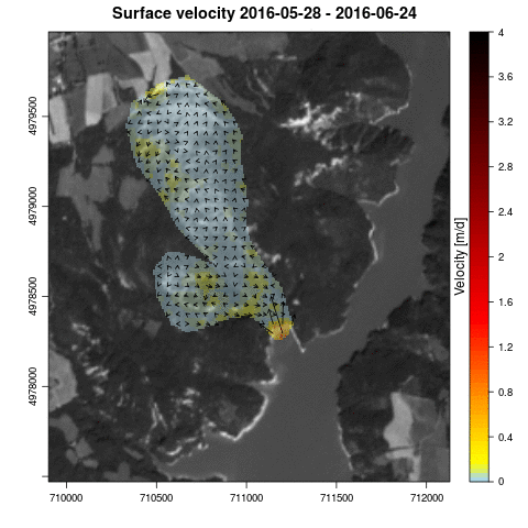
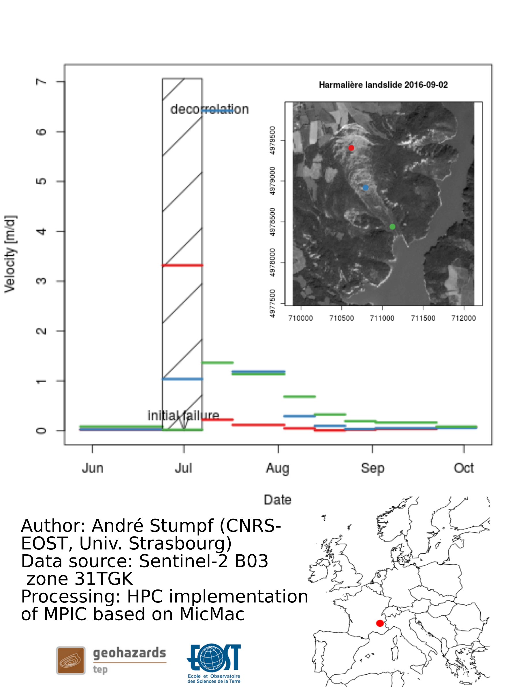
A prototype of the algorithm has already shown promising results for the monitoring of slow-moving landslides from time-series of Pléiades stereo-pairs. The algorithm and the results are presented in a recently published article in Remote Sensing of Environment. In the context of GEP, the algorithm has been further developed to enable to process of Sentinel-2 image time-series and better compensate co-registration residuals. The algorithm has also been optimized for rapid processing of large (spatial, temporal) datasets. An example of results is the quantification of the surface displacements of a developing failure (July-October 2016) observed at the Harmalière
landslide (see Figure below). The service is able to yield velocity time-series distributed all over the landslide. Such information can complement on-site observations (seismology, geodesy) for understanding the mechanics of the failure.
Reference: Stumpf, A., Malet, J.-P., Delacourt, C. 2017. Correlation of satellite image time-series for the detection and monitoring of slow-moving landslides. Remote Sensing of Environment, 189: 40-55. doi:10.1016/j.rse.2016.11.007
Velocity time-series for the Harmalière landslide (May-October 2016) derrived from image correlation of Sentinel-2 L1C