Since 2016, the 100m resolution (with 50m spacing) Sentinel-1 InSAR browse service of DLR is available publicly, over parts of the global tectonic mask defined by the CEOS WG Disaster.
With the release of the GEP v2, public access to a high-resolution version of the InSAR Browse service will be offered by DLR, Terradue and ESA, with coherence and amplitude measurements at 50m resolution (25m spacing), processed in a systematic way, over predefined areas of interest (see the list further below, under section “Current Service coverage”).
Furthermore, GEP is offering to its early adopters the privilege to request for additional areas of interest (AOI), to be added for systematic production. Starting from July 2018, we’ll review candidate applications and select 5 new early adopters. In exchange of their feedback about the service, we’ll configure the InSAR Browse High-Resolution (50 meters) service to monitor their proposed AOI over a defined time period.
Background
The “Sentinel-1 InSAR Browse” information layer was born early 2016 when the European Space Agency (ESA) agreed with the German Aerospace Center (DLR) and Terradue to provide ‘interferometric synthetic aperture radar’ images as an “image browse" service on GEP.
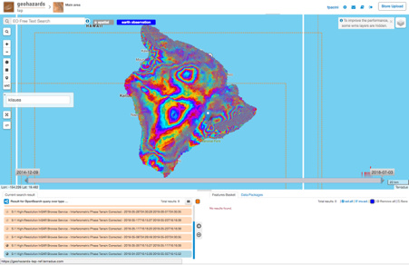
The images are intended for visualisation purposes, and not as products designed for use in further processing chains. Pairs of Copernicus Sentinel-1 SAR images from consecutive passes over the same spot on Earth are processed, either continuously and automatically, or on-demand. The delivered information comprises amplitude, coherence and interferometric phase layers.
The medium-resolution flavour of the service is providing public access to 100 meter resolution images over parts of the global tectonic mask. Over time, the coverage of that information layer is gradually improved. It started with the European tectonic plate, and is progressively ramped up to ultimately cover the global tectonic mask.
In addition, the high-resolution flavour of the service is providing 50 meter resolution products over selected targets. It was initially delivered only to a group of expert users working in ESA research and development studies looking into volcanism.
So, the current high-resolution productions will be released as a public information layer starting July 2018. New targets will be added through the opened opportunity.
How to apply
Applicants can download the GEP User Request Form, or ‘URF’ (click on the menu “File” and then “Download as”). Fill the form as a “GEP Scenario 3” request, and send it back to geohazards-tep@esa.int
The candidate applications simply have to describe:
- Requester point of contact
- Intended scope of work with the generated products
- Area of interest and time span of the data acquisitions for the study
Selected applicants will join as part of the GEP Early Adopters Programme, thus committing to contribute progress updates on their URF activities, and to share and promote their study results generated on the Platform. This implies to:
- share with ESA and Terradue a detailed activity plan with tentative milestones
- produce and share results on the GEP
- produce presentations / publications about the work carried out on GEP
Current Service coverage
Hereafter, the list of areas being currently monitored with the high-resolution InSAR Browse service.
- 22 volcanoes from the CEOS volcano Pilot. See also the Figure 2 on this post.
- Agung volcano, post-eruption monitoring
- Majon volcano, post-eruption monitoring
- Kadovar volcano, post-eruption monitoring
- Kilauea volcano, post-eruption monitoring
- Fuego volcano, post-eruption monitoring
- Kilauea volcano, post-eruption monitoring
- Galeras volcano, volcano-tectonic events monitoring
- Corinth Rift Laboratory (CRL-NFO)
- Rabat/Casablanca (Morocco)
- Mali (border with Algeria), drought areas
- San’a’ (West Yemen), war damage assessment
- Mosul (Iraq), war damage assessment