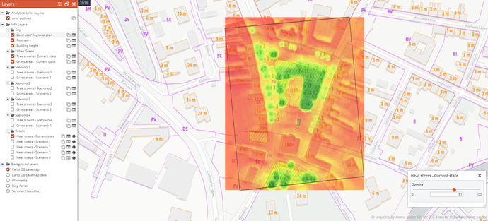
The Climate-fit.city results for Prague, Hodonín and Ostrava are available via the TEP Urban platform. The project provides the generation of the Very High-Resolution temporal maps predictions for the Urban Heat Island. For Prague and Ostrava, we also integrated a processor for the generation of the updated Urban Heat Island maps in the 100m resolution based on the provided Land Use / Land Cover data.
The results:
Very High Resolution Hodonín
If you are interested in more results join the platform and join the Gisat community:
https://urban-tep.eu/#!communities/details/gisat
About the Climate-Fit project
Urban areas are very vulnerable to the impacts of climate change, because of the high concentration of people, infrastructure, and economic activity, but also because cities tend to exacerbate climate extremes such as heat waves and flash floods. Climate-fit.city will translate the best available scientific urban climate data into relevant information for public and private end-users operating in cities across a range of different sectors.
