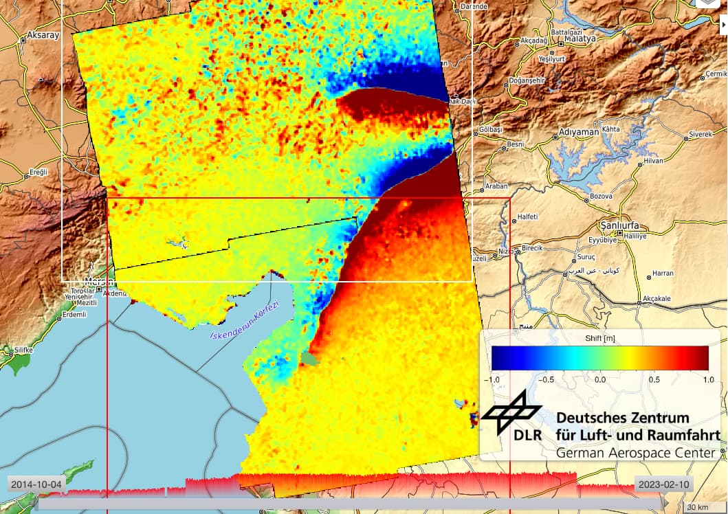
The two images represent the range shift (top) and azimuth shift (bottom) measured using acquisitions of 9 february and 28 january and the InSAR processing service integrated by the German aeronautics and space research centre DLR on the Geohazard Exploitation Platform GEP.

1 Like
link to the public data package : Geohazards TEP - Geobrowser
1 Like