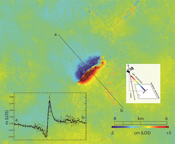
This week, southeast France was hit by a magnitude 5 earthquake with tremors felt between Lyon and Montélimar. The Copernicus Sentinel-1 radar mission has been used to map the way the ground shifted as a result of the quake. Read the news story at ESA - French earthquake fault mapped
Illustration of a product derived from the Copernicus Sentinel-1 mission using the acquisitions of 6 and 12 November 2019. The interferogram was generated with the GAMMA processing chain. Contains modified Copernicus Sentinel data (2019), processed by BRGM.
There are several examples of S-1 based interferograms on the GEP.
