In the framework of the ESA programme for collaborations with International Financial Institutions, the EO4SD DRR consortium led by INDRA and accompanied by GEP’s developer and operator Terradue conducted a 5 days training event with DRR user organisations of Indonesia. This event was organised by the Asian Development Bank in the context of the large reconstruction activity following the M7.4 earthquake that hit Sulawesi in September 2018.
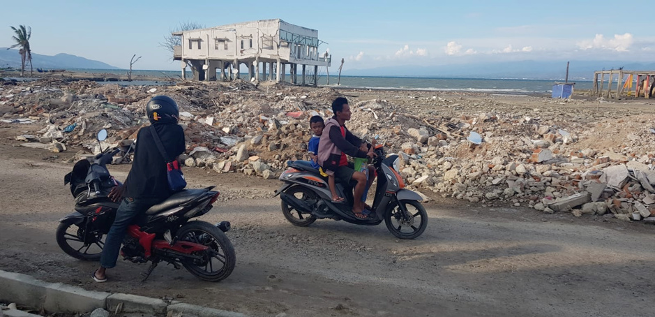
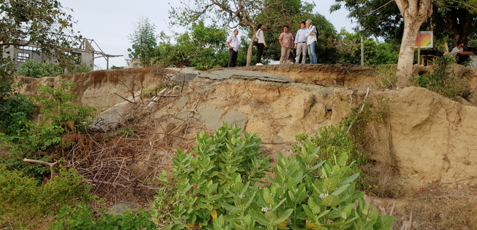
Top: The area destroyed by the Tsunami, Bottom: Scarp of shallow landslide triggered by liquefaction during the Sulawesi earthquake of September 2018.
The consequences of the Sulawesi earthquake – that triggered a tsunami - are still visible in different zones. However, earthquakes are not the only natural hazards impacting Indonesia and the workshop was the occasion to present the different services of the Geohazards Exploitation Platform (GEP) for earthquakes, volcanoes, landslides and subsidence monitoring.

The famous floating mosque submerged in water after the devastating earthquake and tsunami
The workshop gathered 25 participants with different and heterogeneous backgrounds. The session included an introduction to EO concepts, data access and cloud based environment as well as a hands-on on GEP for users’ practical application. It was the occasion to introduce the Copernicus Sentinel constellation and stress the importance of the Sentinel-1 and -2 satellites for DRR applications. The participants were also trained to the traditional processing approach consisting in downloading and processing the data locally. This was essential to understand the benefits of using a platform such as GEP that overcomes the bandwidth and computing capacity limitations.
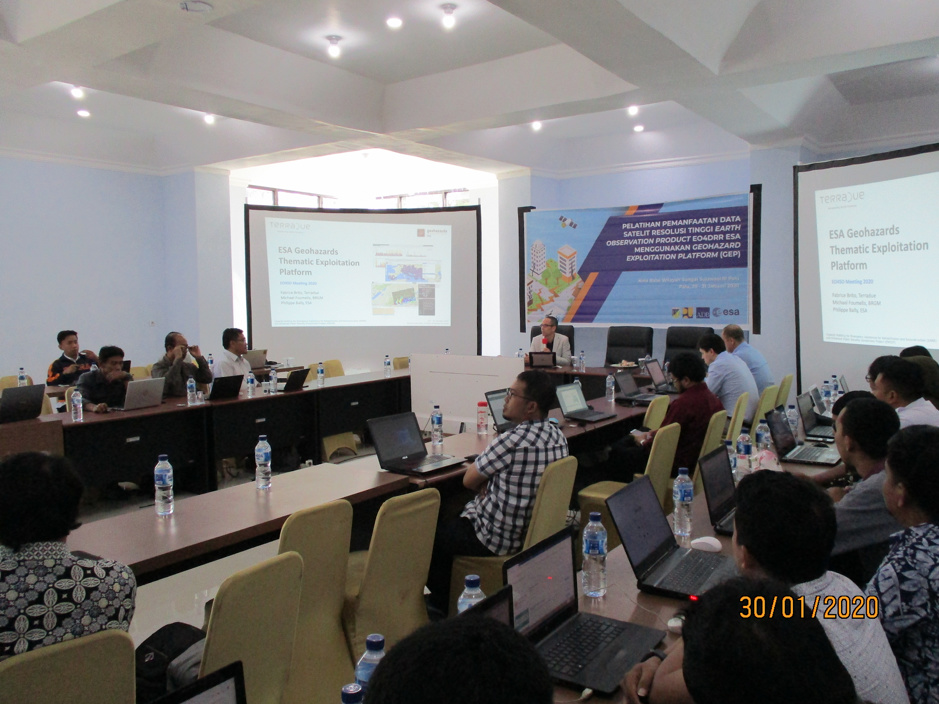
Hands-on session on GEP
The hands-on session provided a detailed introduction to the GEP environment where the participants used GEP on their computers. The exercises focused on two real cases: the 2018 Sulawesi earthquake and the floods of January 2020 that have impacted Jakarta. This was the occasion to explore the Sentinel-1 and -2 catalogues available on the GEP and to run different jobs using two pre-processing services available in the GEP service catalogue. A Sentinel-2 cloud free mosaic has been realized over Palu showing the impacts of the earthquake while RGB composite were realized with Sentinel-1 acquisitions over Jakarta showing the flood extension.

The participants’ workstations showing Sentinel-2 processing results over Palu
The workshop was also the occasion to visit sites impacted by natural hazards such as one of the area in Palu damaged by liquefaction during the Sulawesi earthquake in September 2018 and discussed the participants practical needs. On the way back from the site, the group spotted a landslide in the mountain nearby. Once back to the training that afternoon, one of the landslide services provided by GEP was triggered to analyse the event!
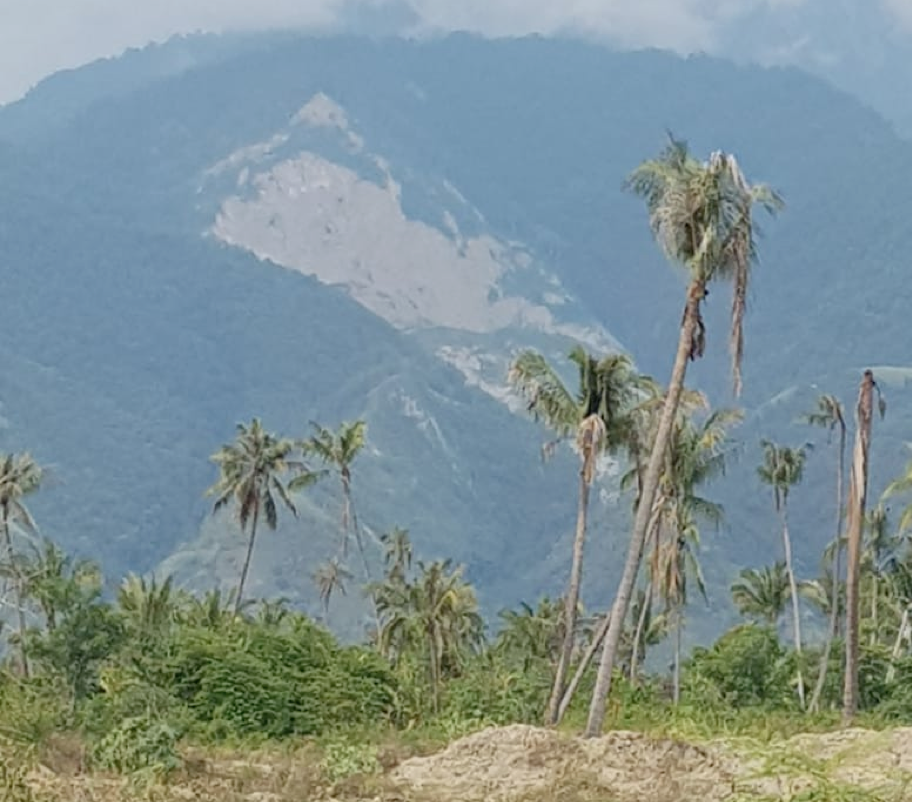
Landslide detected during the field trip
It was great to witness the enthusiasm demonstrated during this session and how the concepts were grasped. We see many processing services triggered on GEP in the days following the training.
The participants feedback showed a great interest on GEP concept and about using Earth Observation in DRR but also expressed the need to have access to more processing services covering a wider spectrum of themes such as forest fires, flood mapping, oil spill detection and terrain motion.