The Island of Crete (Greece) is at a crucial location right above the African subducting slab, and the impact of the plate convergence is imprinted on both the island morphology and the high magnitude earthquakes that are common in this part of Southern Europe.
The Arkalochori village in central Crete was hit by a M6.0 earthquake on 27 September 2021, causing casualties, injuries, and severe damage to infrastructure. Due to the absence of apparent surface rupture and the initial focal mechanism solution of the seismic event, multi-disciplinary research was complementary initiated by combining seismological and remote sensing data processing, followed by extensive field validation.
The contribution of Geohazards Exploitation Platform (GEP) platform in the early response phase of an earthquake has been already well demonstrated. For the Crete M6.0 2021 event, co- and post-seismic surface displacement measurements were retrieved by DInSAR analysis of Copernicus Sentinel-1 mission data, using the GEP DIAPASON service. The in-parallel exploitation of satellite data from independent data tracks, indicated co‐seismic downthrow of the epicentral area of approximately 20 cm. The spatial continuity of the co-seismic interferometric fringes signified that the rupture did not reach the surface, while their higher density at the eastern part of the epicentral area with higher ground displacement gradients, also indicated proximity to the upper part of the activated rupture zone. This information was critical to support field investigations, especially at the early phase of the geohazard event.
The analysis of EO measurements together with seismological and in-situ observations provided insights on the main seismic event, the fault activation, as well as the evolution and contribution of the post‐seismic motion.
For detailed information please refer to the recently published article.
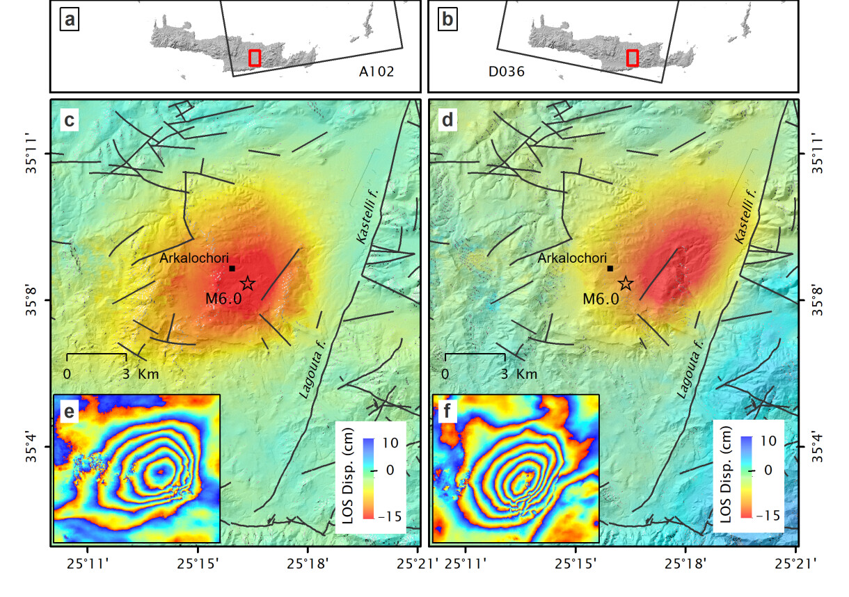
Figure 1 - Co‐seismic LoS displacement maps and the corresponding wrapped differential interferograms, as derived using GEP DIAPASON service, for Sentinel-1 ascending A102 (23 September 2021 – 29 September 2021) and descending D036 (25 September 2021 – 1 October 2021) tracks. Black lines correspond to fault zones, whereas a star marks the epicenter of the 27 September 2021 mainshock.
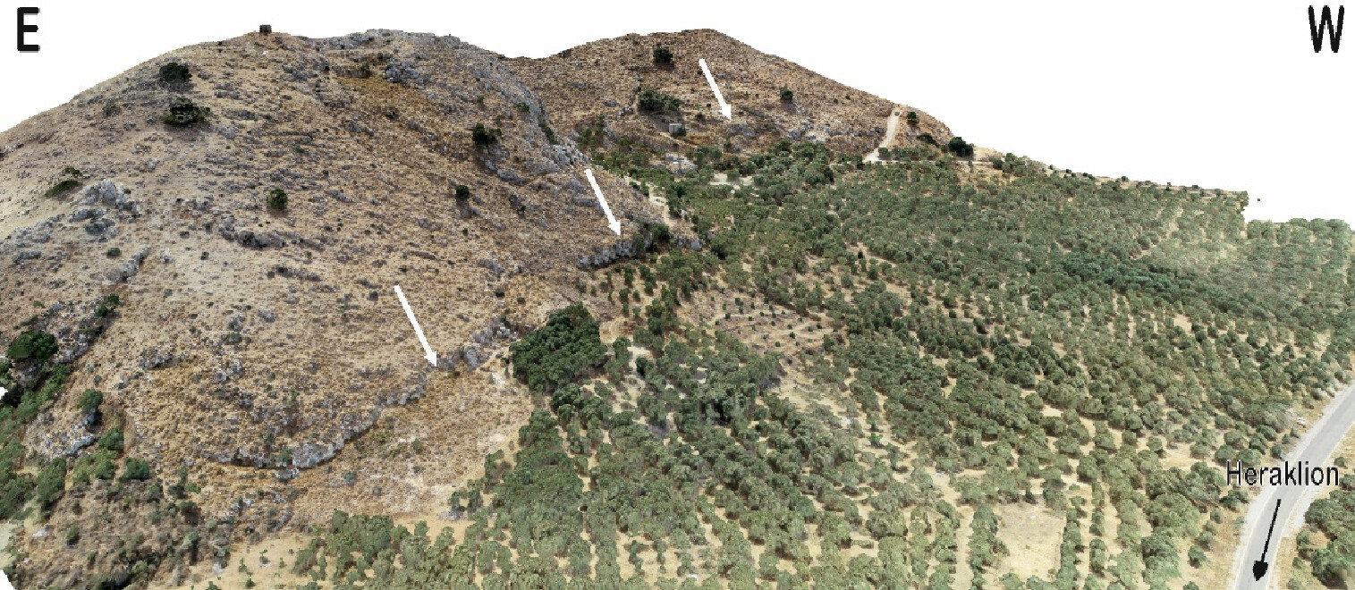
Figure 2 - Photorealistic 3D model of a Kastelli fault segment, an active fault segment nearby the triggered tectonic structure. Morphological discontinuities (white arrows) along faults clearly indicate their activity during relatively recent geological era.