The P-SBAS Sentinel-1 processing on-demand, a service for ground deformation monitoring, has been developed and integrated by CNR IREA into the Geohazards Exploitation Platform (GEP) and is part of the Services Catalogue of the platform since last June 2019.
P-SBAS stands for Parallel Small BAseline Subset and it is an advanced DInSAR processing chain for the generation of mean velocity maps and corresponding deformation time series from stacks of Copernicus Sentinel-1 SLC data. The employed interferometric technique produces not only the maps of ground deformation measured along the line of sight of the sensor, but taking advantage of a series of images (instead of only two as conventional DInSAR) acquired over time, allows monitoring the temporal evolution of deformation.
The service is now operated on the GEP and is running on DIAS resources, sponsored by the ESA Network of Resources initiative, supporting up to 500 Copernicus Sentinel-1 images per run. Starting from end of June 2019 it has been already open to 52 Early Adopters from 38 user organizations worldwide. More than 300 runs with large stacks of Copernicus Sentinel-1 datasets for multitemporal analysis have been successfully submitted so far.
The P-SBAS Sentinel-1 processing on-demand service is currently being integrated in a new GEP production environment to improve its auto-scaling capability and will be also deployed on Amazon AWS resources, thus allowing to further enlarge its user base.
User requests for accessing the service are evaluated by Terradue, ESA and CNR-IREA. You can contact us by replying to this topic, or by email to the GEP contact email.
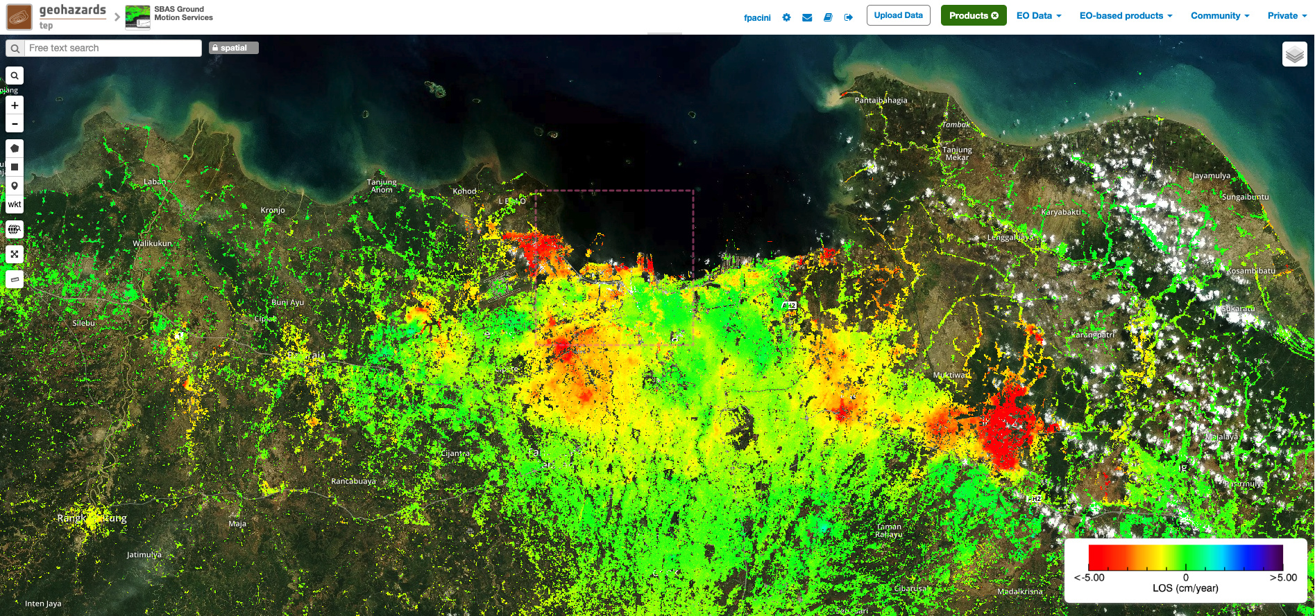
Sentinel-1 ground deformation map at 90 m. resolution of Jakarta (Indonesia) based on multi-temporal interferometric processing (117 images) using the GEP P-SBAS processing on-demand service. Copyright: Contains modified Copernicus Sentinel data (2019), processed by GEP, CNR-IREA & BRGM.