Two new optical services, MPIC-OPT and DSM-OPT, have been integrated by EOST, the “Ecole et Observatoire des Sciences de la Terre” a joint research unit of CNRS and University of Strasbourg, into the GEP and will be offered to users as part of the Services Catalogue of the just released GEP v2.
MPIC-OPT (Mulitple-Pairwise Image Correlation) allows to measure horizontal surface displacements from time-series of optical satellite (Sentinel-2). This service targets the detection and measurement of horizontal ground motion (e.g. co-seismic slip, landslides) based on sub-pixel image correlation. It allows to jointly analyse single pairs or time-series of Sentinel-2 and orthoimages and provides time-series of horizontal displacement maps along with a map indicating the distribution of persistent surface motion during the analyzed time period.
DSM-OPT (Digital Surface Models from optical stereo satellite images) allows to generate digital surface models and orthoimages from stereo- and tri-stereo satellite images acquired by the VHR Pléaides satellites. The implemented pipeline is based on the open-source photogrammetry library MicMac and is designed for distributed processing on a cloud-based infrastructure. The service can be employed in pre-defined processing modes (i.e. urban, plain, hilly, and mountainous environments) or in an advanced processing mode (i.e. in which expert-users have the possibility to adapt the processing parameters to their specific applications).
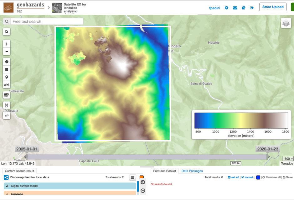
Figure 1: DSM-OPT Digital Surface Model over Norcia (Italy)