Post contributed by TRE ALTAMIRA on April 21st (source)

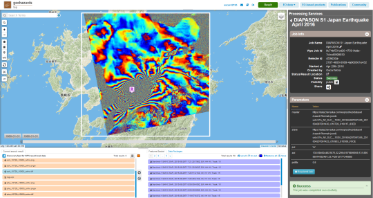
Sentinel-1 interferogram of Kumamoto earthquake, on the island of Kyushu in southwest Japan, in April 2016: generated online, using the DIAPASON Processing Service of the Geohazards Exploitation Platform
“We have generated a new Sentinel-1 interferogram in the cloud on the Geohazards Exploitation Platform (GEP), the initiative developed by the European Space Agency (ESA). The platform is sourced with elements (data, tools, and processing, including INSAR) to support the exploitation of satellite EO for geohazards.
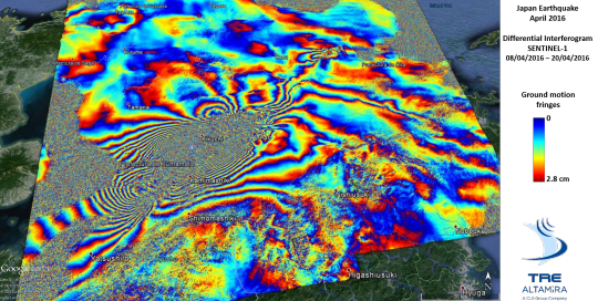
The interferogram was generated on the platform and shows the ground displacement caused by the earthquakes that struck Japan by mid-April 2016. Two major earthquakes caused significant damage in and around the city of Kumamoto, on the island of Kyushu in southwest Japan. The first quake occurred on Thursday 14 April with a magnitude of 6.2 and was followed by several aftershocks until the bigger 7.0 magnitude quake on Friday 15 April which led to the earlier, smaller event to be reclassified as a foreshock. Both events are included in the period covered by the interferogram made with two Sentinel-1 images: one on 08 April (prior to the events), the other on 20 April 2016.

Sentinel-1 differential interferogram (08/04/2016 - 20/04/2016) of the Kumamoto earthquake [image credits: contains modified Copernicus Sentinel data (2016), processed by TRE ALTAMIRA]
The earthquakes epicentres were relatively close to the surface, at a depth of about 10 kilometres. According to the USGS the shallow depth and faulting mechanism of these earthquakes indicate that they occurred on a crustal fault within the upper Eurasia plate. In contrast to this recent sequence of shallow earthquakes, most seismicity in the Kyushu region is related to the subduction of the Philippine Sea plate at depth. Check the USGS web page for the latest information.
The two earthquakes killed more than 40 people and caused several structures to collapse. The resulting landslides have destroyed roads and communities.
The GEP cloud based model of community building in technology cooperation is paving the way for a full exploitation of the benefits of processing of EO data. The ultimate aim of the satellite-based services community is to keep finding ways of contributing more efficiently to the management of geohazards.”
TRE ALTAMIRA is a member of the GEP consortium.