On August 14, 2021, a Mw 7.2 earthquake struck the Tiburon Peninsula of western Haiti triggering thousands of landslides. Three days after the earthquake on August 17, 2021, Tropical Storm Grace crossed shallow waters offshore of southern Haiti triggering more landslides. In the aftermath of these events, several organizations with disaster response capabilities provided information on the location of landslides to first responders on the ground, using both satellite remote sensing data and on-line processing services. The results and the datasets have been recently published in a collaborative manuscript in Natural Hazards “Amatya, P., Scheip, C., Déprez, A., Malet, J.-P., et al. Learnings from rapid response efforts to remotely detect landslides triggered by the August 2021 Nippes earthquake and Tropical Storm Grace in Haiti” accessible here.
The ALADIM (-HR/-VHR) service accessible on GEP has been used on both Sentinel-2 and Pléiades imagery for landslide mapping; the method can be applied at any time to any place on Earth with appropriate satellite imagery. ALADIM has a complex workflow, introducing OBIA (object-based image analysis) and machine learning models, highly optimized in the GEP platform in terms of calculation time, and is fully automated except for the setup of a training sample. Application of the service allows increasing the accuracy and completeness of the produced landslide inventory.
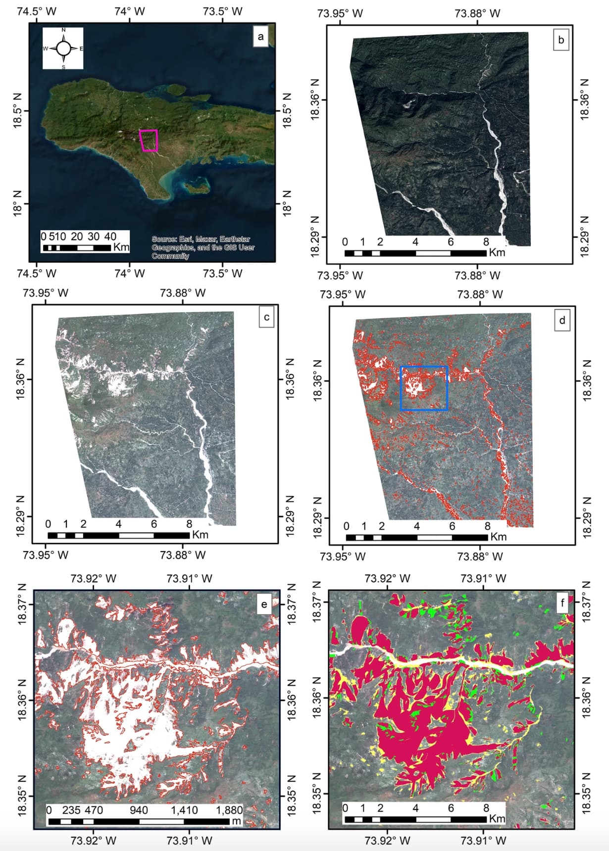
The figure below presents the ALADIM products generated in change detection mode (change detection processing with a pre-event image Pléiades image of December 2015 and a post-event image of August 2021): a Location of the use case in the central part of Pic Macaya National Park (e.g., overlapping area of the 2015 and 2021 Pléiades imagery); b Pre-event (December 21, 2015) Pléiades image; c Post-event (August 23, 2021) Pléiades image; d ALADIM change detection generated landslide product for the whole area; e Zoomed in view of the detected landslides; f Accuracy metrics (Pléiades ©CNES 2021, Distribution Airbus DS).
Do not hesitate to use the service for your application by registering on GEP.