Cloud free coherence imagery using the Sentinel-1 Copernicus mission provides wide area hazard monitoring capability and can help detect landslides. Following the landfall of Tropical Storm Megi over the Philippines on 10 April 2022, severe landslides and floods hit the east and south coasts of the archipelago, particularly affecting areas such as the region of Baybay city in the bottom left corner of these images.
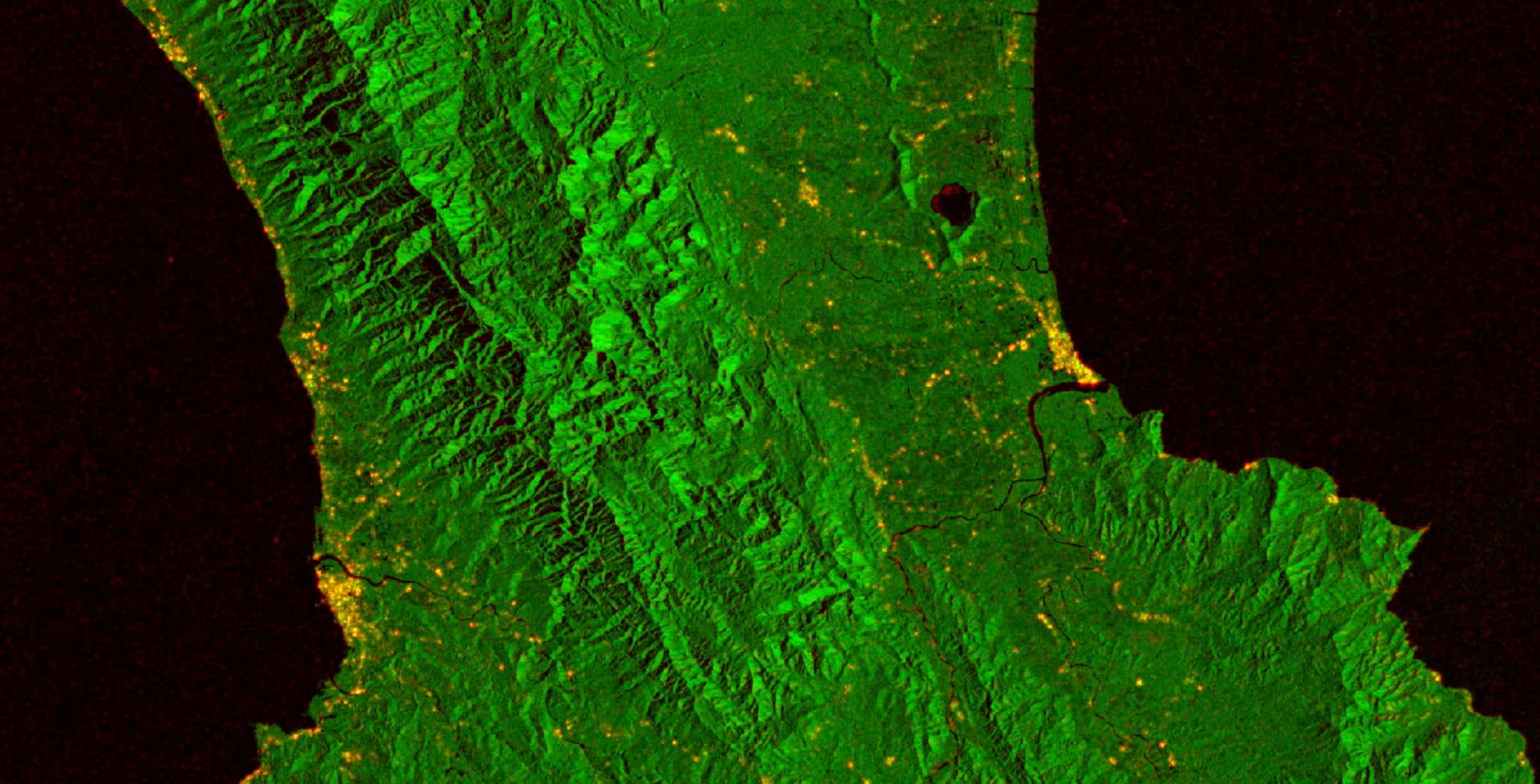
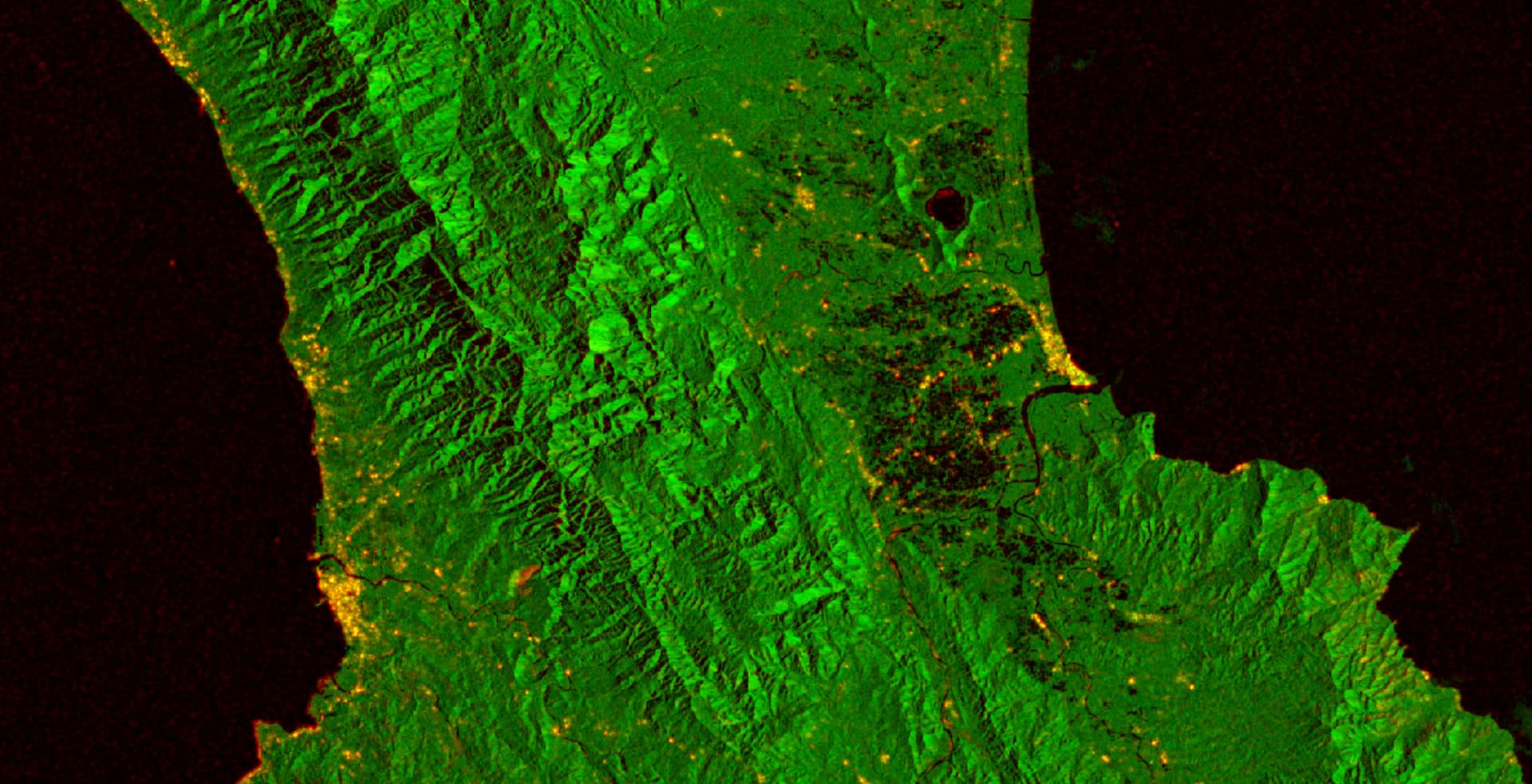
The top image shows coherence (red) and amplitude (green) using pre-event acquisitions (5 and 17 February) while the bottom image is using post-event acquisitions (18 and 30 April).
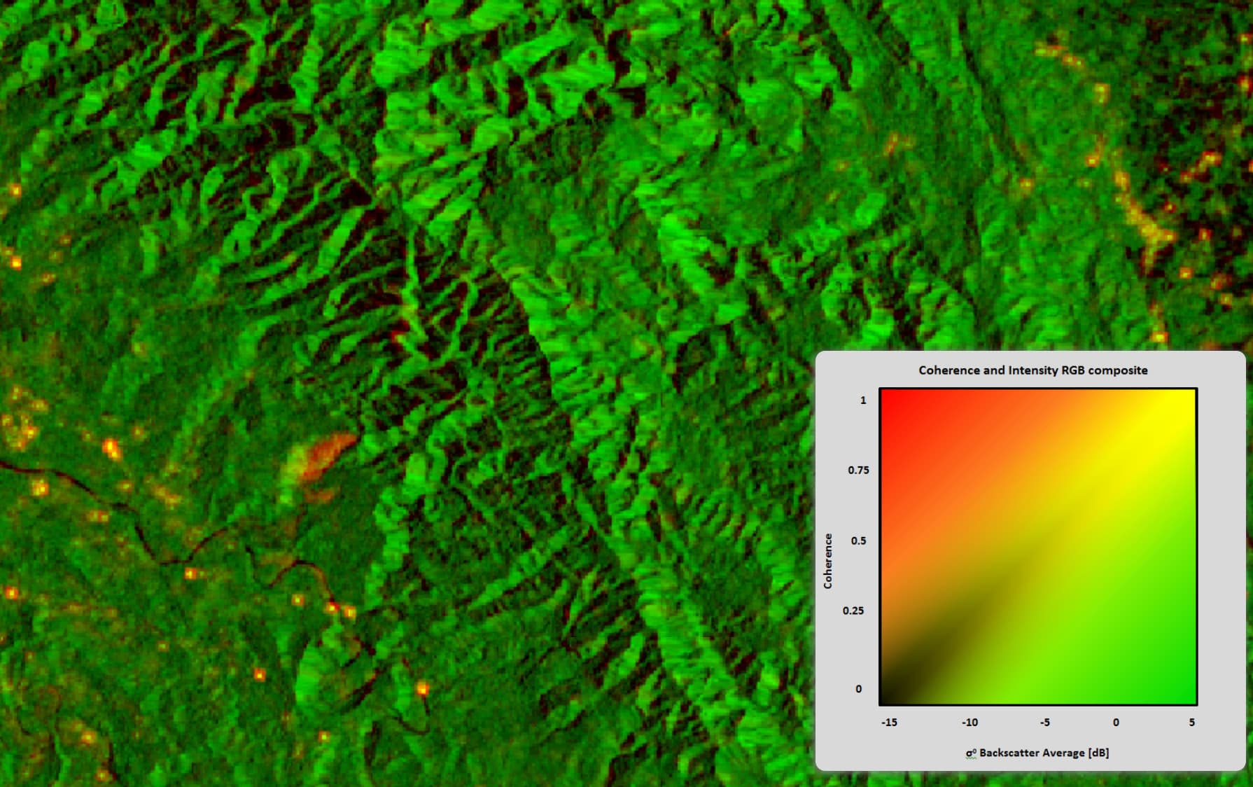
The increase of coherence is typical of bare soil following the removal of the vegetation cover. Other parts of the amplitude coherence composites show the footprint of flooding with many areas to the right of the scene with a decrease of the amplitude in radar observations over water bodies. With missions like Sentinel-1 both coherence and amplitude data provide synoptic viewing capability over wide areas and can help better understand hazards.