Radar interferogram over Herat area in Afghanistan using the Copernicus Sentinel-1 acquisitions of 7 October and 25 September 2023 following the Mw 6.3 earthquake sequence of 7 October

The image represents the radar interferogram generated using Copernicus Sentinel-1 acquisitions of 7 October and 25 September and the DIAPASON InSAR processing service following the Mw6.3 earthquake that hit Herat City in Herat Province, western Afghanistan on 7 October.

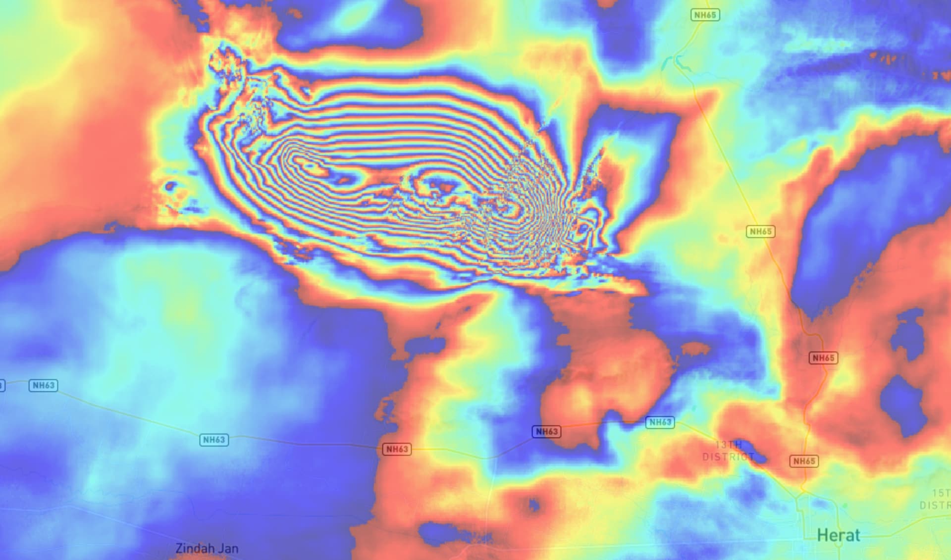
The service chain has been integrated by TRE Altamira on the Geohazard Exploitation Platform GEP and is an InSAR tool suite developed by the French Space Agency (CNES) and maintained by TRE Altamira. This service performs an InSAR workflow on Sentinel-1 TOPSAR (IW,EW) data, producing interferograms, amplitude and coherence maps.

The Data package is available here.

@philippe.bally I’d like to access the data package to compare the ground deformation with the overall distribution of the seismic sequence, but I cannot access. Could you please support me in accessing the data? Moreover, are you performing also the interferogram including the latest events on the 15th Oct? Many thanks for the information!

Dear Chiara,
we’ve made the data package public (as initially intended to be)
Please try again the link, it should work now.
Best regards
Hervé