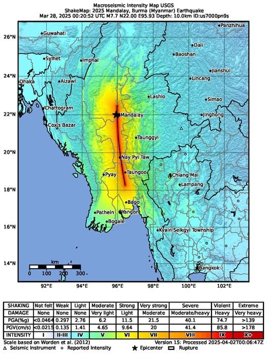
On April 2nd, 2025, a significant earthquake struck central Myanmar. Early seismic reports indicate widespread ground displacement and potential impacts across the region. This Wikipedia article provides a general summary of the event.
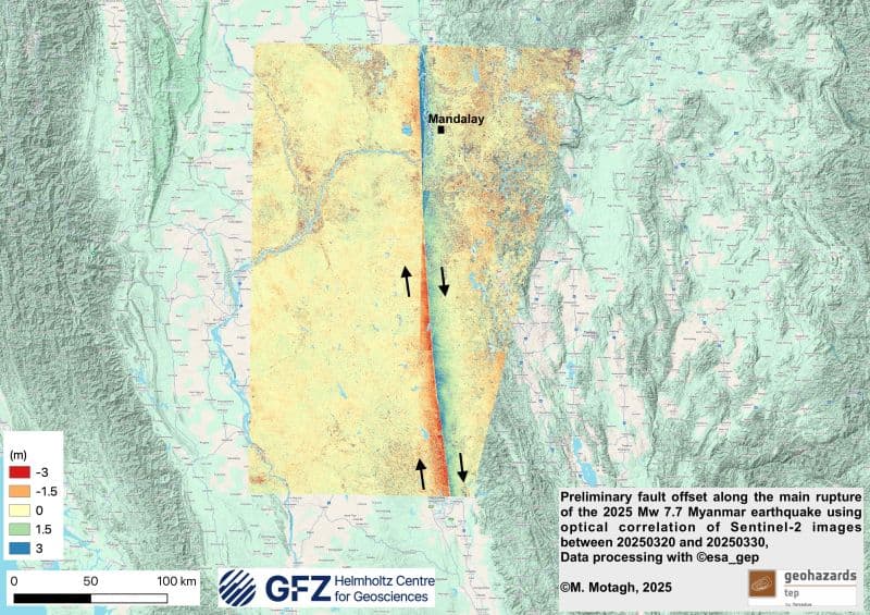
Soon after, researchers in the Earth Observation community began to publish first results using Sentinel-1 data. Among the earliest updates were two interferograms shared by the Remote Sensing for Geohazards team at GFZ. The data was processed using services on the Geohazards Exploitation Platform (GEP) operated by Terradue.
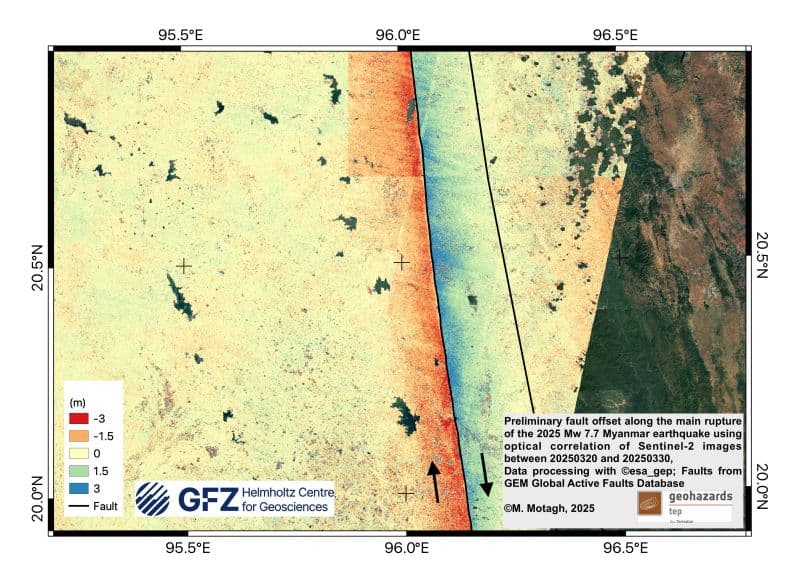
The products generated by GFZ provide a first view of the deformation field caused by the earthquake.

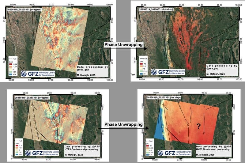
In a later post, the GFZ team noted a difference between interferograms processed at different facilities and those from the GEP. An error in orbit file application led to incorrect deformation signs in some results, an issue that did not affect the products processed through the GEP. This underlines the importance of cross-checking outputs from independent processing environments, especially during rapid response phases.
Other posts from the same team included observations near dams and other infrastructures, aiming to highlight areas where further monitoring might be required.
The Myanmar earthquake response highlights how researchers use GEP to:
- Access Sentinel-1 and other EO datasets
- Run on-demand processing using InSAR and time series analysis services
- Share results openly to support scientific understanding and response
You can explore the services and data used in these analyses via Geohazards Exploitation Platform