The island of Sao Jorge, in the Azores, has registered more than 20,000 small earthquakes, with magnitudes up to 3.8, since 19 March 2022.
The activity started under the NW part of the island and is most likely caused by a magmatic intrusion at 10-15 km depth that could indicate renewed eruptive activity in the future.
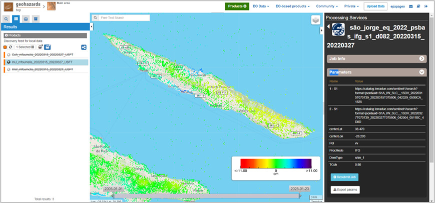
Figure 1. Ground deformation (15/03/2022-27/03/2022) at São Jorge Island using P-SBAS service on GEP.
Ground deformation was detected from the analysis of Synthetic Aperture Radar (SAR) data acquired by the Copernicus Sentinel-1 satellite mission through GEP platform. Results obtained by the P-SBAS and DIAPASON services are consistent showing significant deformation patterns given the low magnitude tremors. Maximum uplift at the order of 10 cm was observed at the affected area.
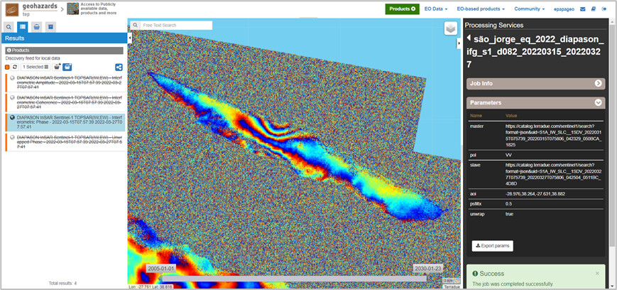
Figure 2. Ground deformation (15/03/2022-27/03/2022) at São Jorge Island using DIAPASON service on GEP.
Results are publicly available for further scientific analysis and interpretation for both P-SBAS and DIAPASON services.