This project is sponsored by the NoR (Network of Resource) program of the European Space Agency (ESA), the Project (ID: 65514) ussing the Geohazard TEP platform and the P-SBAS algorithm developed by the CNR-Irea of Italy. This work is a collaboration of the Sapienza University of Rome with the Center for Water Resources (CRHIAM) and the Civil Engineering Department of the University of Concepción, Chile.
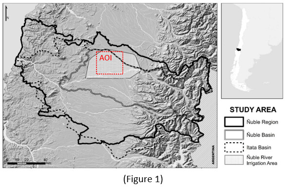
The objectives of this work is to measure the regeneration of the aquifer in seasonal periods of summer and winter, our preliminary results show a trend in the compressibility of the aquifer due to the plasticity properties of the soil, decreasing of capacity of the aquifer. The area study is located in central Chile at latitude 36.9°S and longitude 71.4°W and drains the southwestern section of the Nevados de Chillán volcanic complex, located in the Andes Mountains (Figure 1). These mountain watersheds are quite complex hydrological systems that provide water resources to downstream communities for irrigation, industrial activities, human consumption, and ecosystem sustainability.
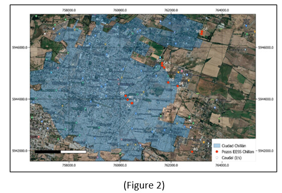
Since the hydrological processes must be closely related to the geological characteristics in fractured rock environments, it is important to observe the local geological and lithological conditions in order to have a broader view of the system under study. The intensive pumping area in Chillan allows the study of the correlation of groundwater exploitation and seasonal variability of the aquifer (Figure 2).
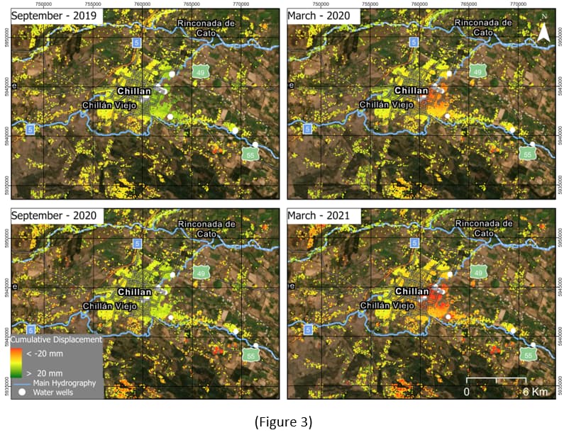
As expected results, it is to measure the seasonal variability of the aquifer, and its correlation with intensive pumping, in addition to knowing the behavior and dynamics of the aquifer, defined by its geological and hydrogeological characteristics. In the Figure 3 shows, the preliminary results show the seasonal variability of summer (March) and winter (September), for the observation period recorded between 2019-2021.
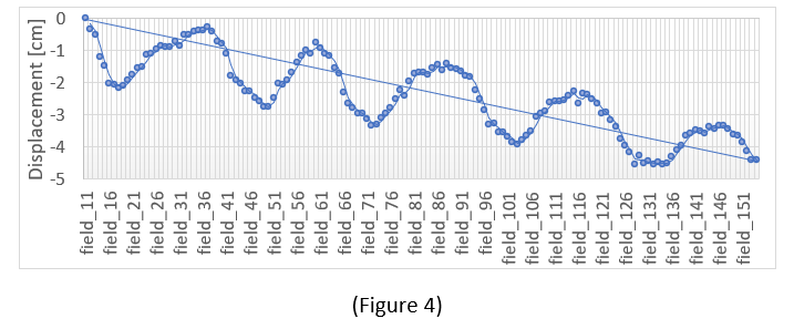
Extending the monitoring period to 6 years, seasonal variability and loss of aquifer recharge capacity can be clearly identified (Figure 4), however we must still validate our hypothesis with in-situ information, rainfall data, pumping and geological characteristics.