I just wanted to share this example of the Sentinel-1 Amplitude Change (SNAC) service for flood detection.
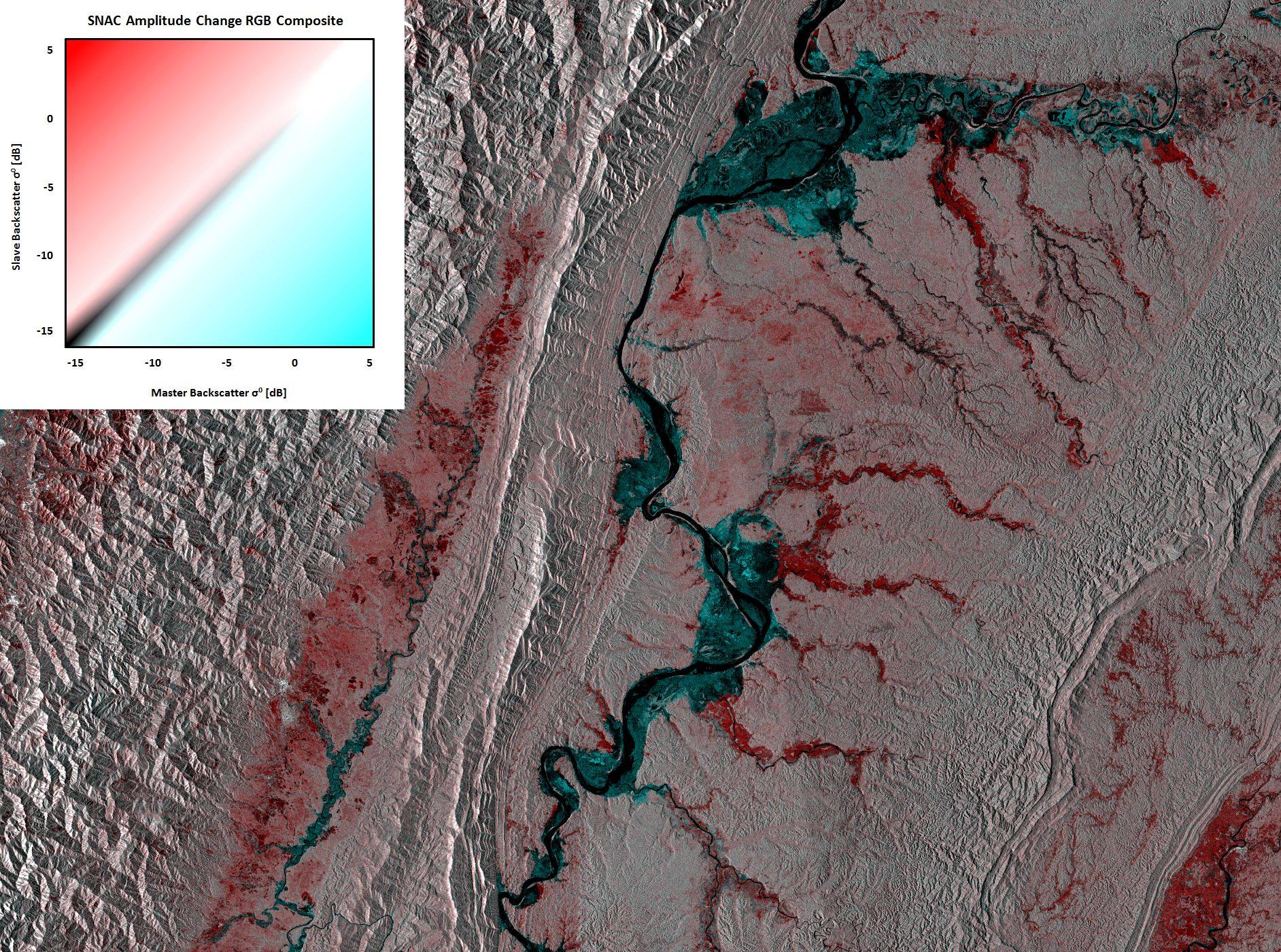
It shows the extent of the floods in the western Sagaing Division in the areas of Homalin, Tamu, Phaungbyin and Mawlaik townships of Myanmar. Heavy rainfall started in July 2015 and lasted until September, leading to massive damages in wide parts of the country, including over 100 fatalities and over 100,000 affected people (Wikipedia).
Two Sentinel-1 GRD products were used:
- Master: 20.03.2015 (before flood)
- Slave: 24.09.2015 (during/after flood)
While the differences in the amplitude are subtle in some areas, the SNAC services creates an RGB composite of calibrated SAR backscatter with R=slave, G=master and B=master. The resulting map enhances the differences between both images, whereas red indicates an increase and blue indicates a decrease of backscatter intensity.
In the case of flood, the smooth water surface reduces the backscatter intensity, leading to a cyan signature of flooded surfaces. Areas in black are covered by water in both images. Grey pixels indicate no change. Red areas result from the large temporal difference between the master and the slave image and indicates areas where vegetation increased during the growing season March and September 2015.
The example shows the potential of operational use of Sentinel-1 data to extract flooded areas in cases of emergencies. Maps provided by UNOSAT/UNITAR used this information (slightly different dates) to greate flood maps (Flood Waters Over Western Sagaing Division, Myanmar)
Open it in Geobrowser v2 to see the data in a spatial context and in its full extent.