The latest development of the SNAPPING services comprised the full (sensor) resolution PSI for detailed terrain motion mapping and monitoring for geohazards applications. In the meanwhile, several other optimizations have been introduced to improve the user experience and performance and to tailor further the processing parameters.
To support a fast analysis and interpretation of the products generated using the service, both for SNAPPING Med and SNAPPING Full, the SNAPPING Visualizer has been released. It is an HTML file available from the results list of a SNAPPING job. It is compatible with common internet browsers and helps with quick and easy inspection of the PSI-based average motion rates. It is an offline and standalone tool so the analysis of PSI measurements can be achieved without the need for data ingestion into any geospatial database or GIS.
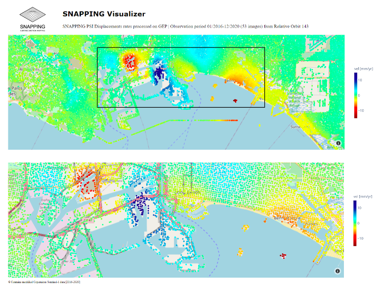
Example of the SNAPPING Visualizer using a medium resolution PSI product over Los Angeles. Bottom image: zoomed area illustrated with the black rectangle.
`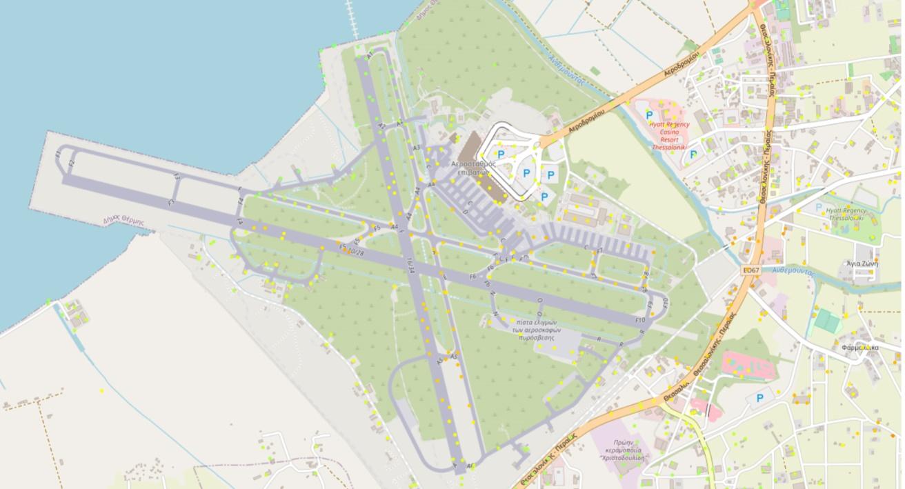
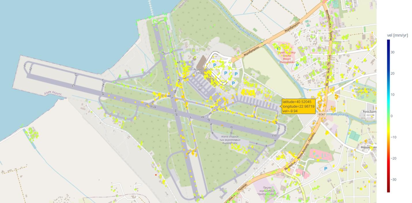
SNAPPING Visualizer for PSI Med service (top image) and PSI Full service (down image) over the Thessaloniki Airport (Greece). Note that when navigating over the image, the color of the label (here in orange) associated with the cursor is adjusted according to the displacement gradient (or velocity) of the measurement point Scatterer selected.
The SNAPPING Visualizer aims at reducing the effort of EO-experts with a rapid inspection tool, while offering a solution to practitioners not familiar with geospatial technologies for investigation of the measurements without much effort involved.
Future versions of the SNAPPING Visualizer will include other functionalities for enhanced exploitation of the information provided with PSI measurements.