Terradue is leveraging its expertise in Earth Observation (EO) and cloud-based platforms to lead the development of the CopernicusLAC Infrastructure, a transformative initiative bringing Copernicus EO services to the Latin American and Caribbean (LAC) regions.
Funded by the European Space Agency (ESA) and supported by the European Commission’s Directorate-General for International Partnerships (DG-INTPA) and the Government of Panama, this infrastructure project is part of a larger collaborative effort to build regional capacity, foster knowledge transfer, and support disaster risk management across LAC.
A Key Initiative for the Latin American and Caribbean Region
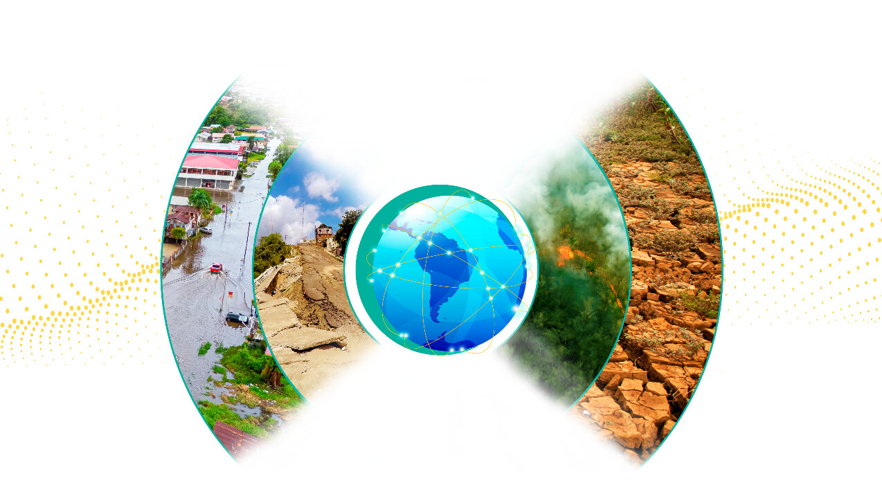
The CopernicusLAC Infrastructure, aims to deliver a cloud-native platform that enables regional stakeholders to easily access, process, and utilise Copernicus satellite data. This infrastructure is being designed to support critical applications including disaster risk reduction, environmental monitoring, and climate resilience.
The project is part of a coordinated set of initiatives, each addressing a different pillar of capability building:
- Stakeholder Engagement and Knowledge Transfer: By engaging local and regional actors, the project ensures that the CopernicusLAC Infrastructure is designed with user needs at the forefront. Through structured training programmes and dedicated workshops, stakeholders are being equipped with the knowledge and skills needed to use the platform effectively and, crucially, to operate it independently by 2027.
- Innovative Services for Disaster Risk Reduction (DRR) : This parallel initiative co-develops EO services tailored to regional needs in hazard monitoring and disaster response. From floods and landslides to earthquakes and hurricanes, the platform provides stakeholders with the tools to process satellite data in near-real time, enabling them to make informed decisions during emergencies.
Terradue’s Expertise in Cloud Infrastructure and Data Processing
As the technical lead, Terradue is drawing on its extensive experience in EO platforms and scalable cloud infrastructure to build a robust and user-centric solution for the region. The platform incorporates:
- Advanced data ingestion and processing capabilities that allow users to handle large volumes of Copernicus data without needing their own processing infrastructure.
- Integrated disaster risk management tools that support real-time decision-making and long-term planning.
- Built-in training and capacity building, ensuring sustainability and local ownership of the platform.
The architecture supports both operational use cases (e.g. rapid response during disasters) and research-focused activities (e.g. climate trend analysis), making it a flexible solution that evolves with the needs of its users.
Example: Burned Area Mapping for Wildfire Monitoring
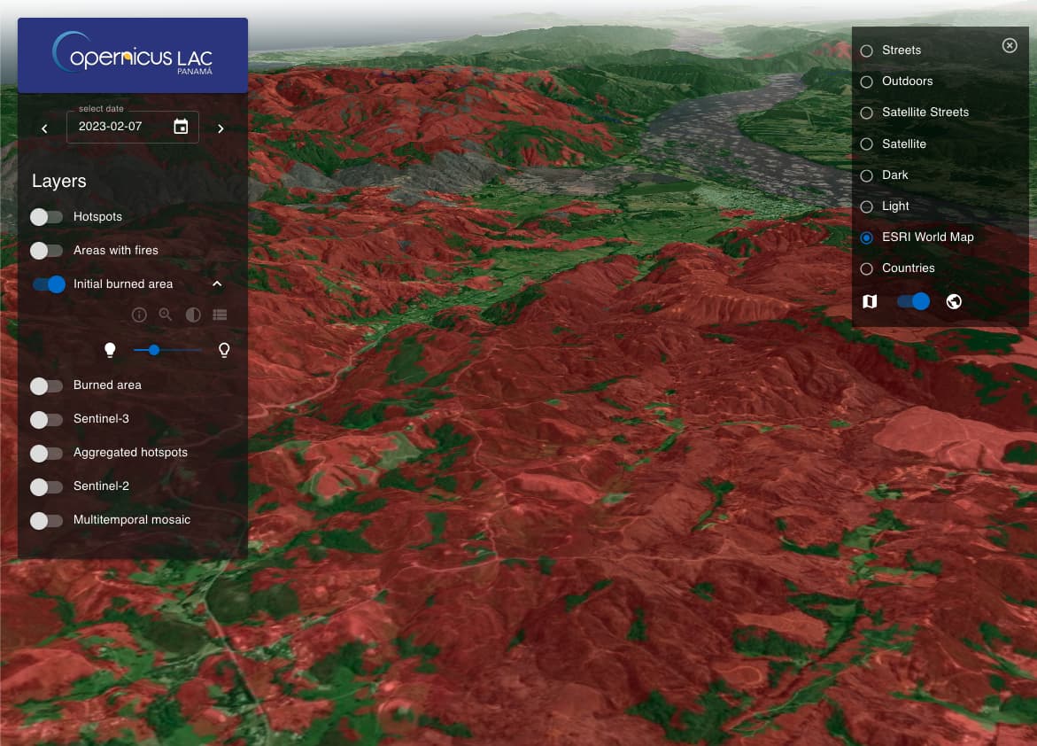
The Burned Area Mapping (BAM) service provides real-time detection and monitoring of wildfires. It automatically generates hotspot and burned area maps through synergic use of EO data from multiple missions. The service supports multi-temporal high-resolution monitoring, enabling timely situational awareness for wildfire management authorities and environmental agencies.
Find online material about the mapping of wildfire events, danger and recovery at:
docs.copernicuslac.terradue.com/services/wildfire/intro/
The Role of Key Partners
The success of CopernicusLAC relies on a strong and diverse consortium of international and regional partners:
- Terradue: Leads the development, deployment, and operations of the cloud infrastructure.
- T-Systems: Brings deep expertise from the Copernicus Data Space Ecosystem, ensuring secure and scalable EO data access and management.
- Universidad de Chile: One of Latin America’s premier academic institutions, it leads stakeholder engagement, capacity building, and training, ensuring the platform’s long-term sustainability and local relevance.
A Collaborative Framework for Sustainable Development
The project reflects the priorities of the EU-LAC Digital Alliance and aligns with the European Commission’s Global Gateway strategy — both of which aim to deepen digital, environmental, and economic cooperation between Europe and Latin America.
National coordination is led by Panama’s Autoridad Nacional para la Innovación Gubernamental (AIG), ensuring the infrastructure aligns with local strategies for digital transformation and disaster risk management.
Together, ESA, DG-INTPA, AIG, and the consortium partners are working toward a shared goal: enabling countries in the LAC region to independently operate and benefit from EO technologies.
Building Lasting Capacity for a Resilient Future
Beyond data access, the CopernicusLAC Infrastructure is designed to empower local institutions. Training programmes led by the Universidad de Chile will equip users with the technical know-how to manage, customise, and operate the platform autonomously by 2027. This transition is critical to ensuring the sustainability and relevance of the project for years to come.
With its emphasis on capacity building, digital innovation, and sustainable development, the CopernicusLAC Infrastructure is more than a technical system — it’s a blueprint for long-term resilience in a region increasingly affected by natural disasters and environmental challenges.
Stay tuned for updates on service deployment, platform access, and stakeholder engagement activities as the CopernicusLAC Infrastructure rolls out across the region.
Check out latest news from CopernicusLAC Panama Centre website at:
https://www.copernicuslac-panama.eu/latest-news/