The Geohazards Exploitation Platform (GEP) now offers the updated European Ground Motion Service (EGMS) Ortho Vertical dataset, covering 2018 to 2022. This product, part of the Copernicus Land Monitoring Service, provides crucial high-resolution ground motion data derived from the Sentinel-1 mission.
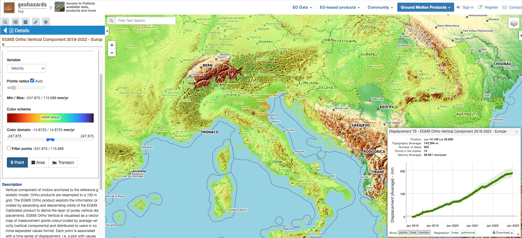
Figure 1: EGMS Ortho Vertical dataset available in the GEP public workspace
One of the standout features of EGMS on GEP is its dynamic visualization capability. Users can interactively display average ground movement velocities on a map, enhancing the understanding of spatio-temporal patterns. The platform also offers extensive customization options, allowing users to adjust layers, look-up tables, and color scales to meet specific analytical needs. Advanced filtering options enable targeted analysis by setting velocity thresholds, and the on-the-fly visualization feature allows for the plotting of displacement time series, generation of statistics, and visualization of geographic transects in real-time. Users can export data in CSV and CovJSON formats, with the option to download original dataset tiles.
The publication of EGMS products on the GEP enhances understanding of geohazards by providing access to both Earth Observation (EO) and non-EO data. This integration supports downstream applications through a suite of online processing services and analytical tools, facilitating comprehensive geohazard analyses and providing actionable insights. Users have unrestricted access to regional and global datasets, which are crucial for environmental monitoring. Advanced services such as Persistent Scatterer Interferometry (PSI) allow users to enrich and update ground motion measurements on-demand.
The platform also facilitates methodological comparisons by integrating SAR and optical EO data, providing reliable interpretations and deeper insights into ground motion phenomena. Post-processing tools enable users to create value-added products, enhancing the utility of the EGMS dataset for various applications.
The integration of the Copernicus EGMS Ortho (level 3) Vertical into the Geohazards Exploitation Platform marks a significant advancement in geohazard monitoring. Researchers, industry professionals, and enthusiasts are invited to explore the rich possibilities offered by these products. By participating in the GEP community, users can contribute to and benefit from collective efforts to advance the understanding of geohazards.
More details about this initiative are available in the GEP portal stakeholders area.
Sponsorship and Support by the Network of Resources (NoR)
The availability of the EGMS Ortho Vertical dataset on the GEP is supported by the Network of Resources (NoR). This sponsorship program enhances the capabilities of organizations and individuals by providing tailored support for the utilization of space assets and resources. For more information about NoR and opportunities for sponsorship, visit their Sponsorship Page.