The Geological Survey of Spain (Instituto Geológico y Minero de España – IGME) from the Spanish National Research Council (CSIC) together with the Universidad de Alicante (SP), Dokuz Eylul University (TU), University of Jordan (JR), University of Pavia (IT) and University of Padova (IT) have recently explored the advanced Interferometric SAR services available on the Geohazards Exploitation Platform (GEP). Specifically, the analysis involved the P-SBAS (Parallel Small BAseline Subset) service of CNR-IREA and the SNAPPING (Surface motioN mAPPING) service of AUTh.

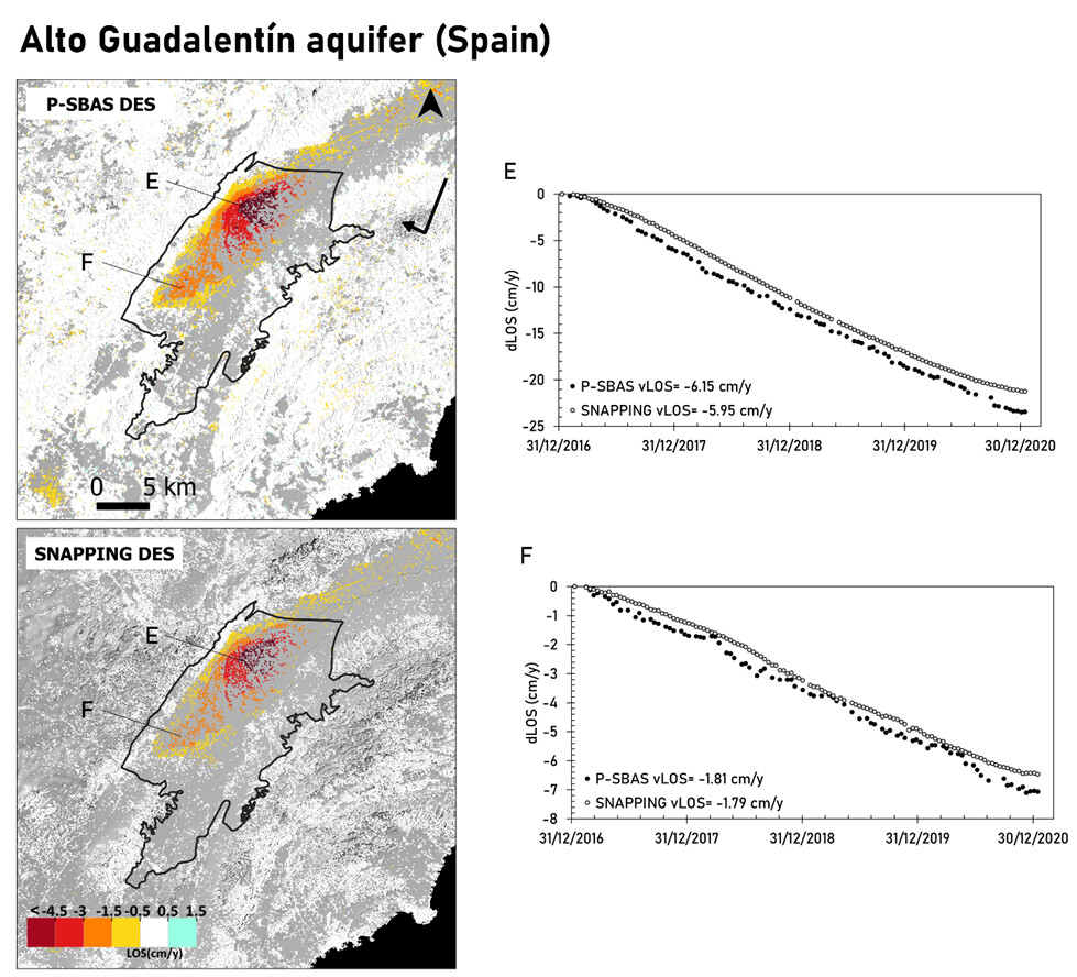
Results over several sites that exhibit land subsidence, including Alto Guadaletin aquifer in Spain and Gediz River Basin in Turkey, show the consistency of terrain motion measurements both in terms of annual rates and displacement time series. This work well demonstrates the maturity and operational capabilities of cloud-based services for mapping and monitoring geohazards.
The friendliness of the interface, the rapid production of measurements and the fact that everything is done remotely on external resources are among the positive comments of the user. Still work has to be done to improve the performance, also adding the option for tuning several processing parameters by expert users.
The work has been presented at ESA LPS2022 under the title “Exploring Land Subsidence with A-DInSAR Thematic Apps of the Geohazards Platform”.