The Band Combination service (COMBI) provides RGB combination from user defined bands of single or multiple EO data products.
Additionally, with the COMBI service, the users can create colorful pictures of satellite data by creating false RGB composites at their choice, as the service also generates 3 RBG composites with specific radiometric conversion in order to optimize the radiometric profile according to the types of target observed.
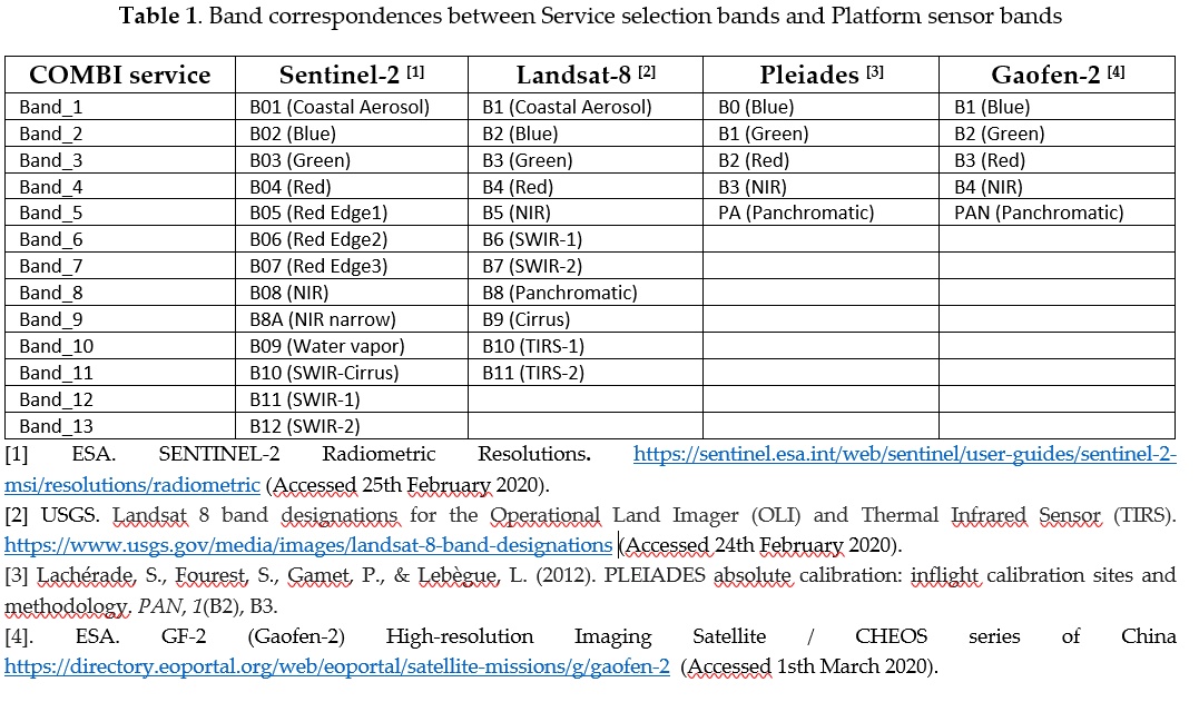
As example, we show the Emi Koussi Volcano viewed by Copernicus Sentinel-2, selecting a false RGB composite using as Red channel (band 11), Green (band 8) and Blue (band 2). This example has been processed by Floriane Provost, Philippe Bally and Jose Manuel Delgado Blasco using the COMBI service available in the GeoHazards TEP.
The service provides several visualization options, such as :
- i) a full resolution product stretched between the 2-96 % values of histogram image (called RGB_S2_12_S2_8_S2_2).
- ii) a full resolution browse product, where the image is stretched using reflectance values ranged [0, 0.3] (called RGB_S2_12_S2_8_S2_2_Browse);
- iii) the full resolution RGB product without applying any visualization option (called RGB_S2_12_S2_8_S2_2_MinMax);

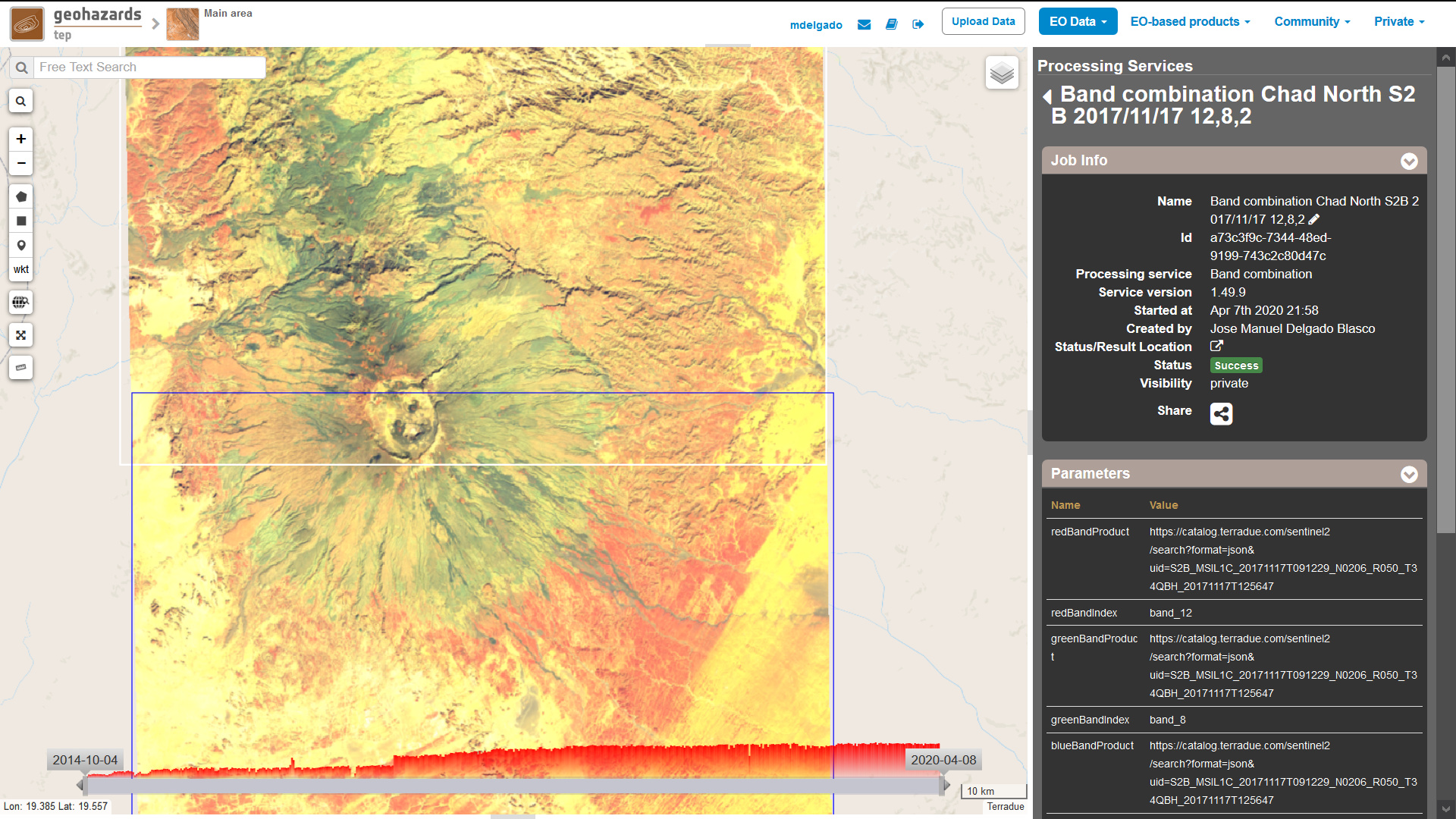
You can get the 3 RGB with different visualization options in the following link: Geohazards TEP - Geobrowser
The COMBI service supports many satellite sensors, both Synthetic Aperture Radar (e.g. ALOS2, Copernicus Sentinel-1, KOMPSAT-5), and Multi-spectral/Optical (e.g. Copernicus Sentinel-2, Landsat, Pleiades and many more) and it creates optimized visualization RGB products for selected sensors. More information about the service can be found in the its tutorial webpage: COMBI - Band Combination — Geohazards Thematic Exploitation Platform 3.15 documentation
Another beautiful example of the Emi Koussi volcano can be found on ESA Multimedia collection in the link below: